 |
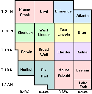
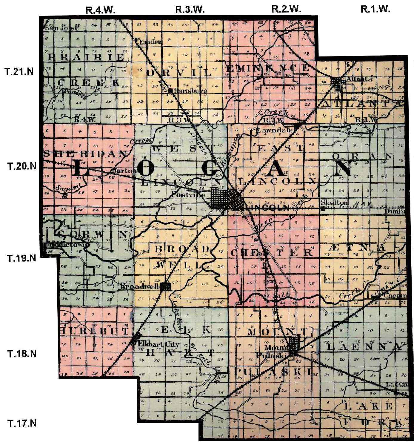
Township Maps |
 |
This page is part of the FREE site located at http://logan.illinoisgenweb.org/. There is NO charge to access any page on this site. If you have arrived here through a pay site click here to go to the original free Logan County ILGenWeb site.
|
|
Township Maps |
|
|
Source: "Atlas
of Henry Co. Illinois to Which is Added an Atlas of the United
States, Warner & Beers Publishers, Chicago, 1875. Contributed to ILGenWeb by
Alice Gless. |
|
|
|
|
What do you do with these maps? First visit Illinois Public Domain Land Sales or the Bureau of Land Management and hunt for your ancestors. You can also use any land record information you have. The Public Domain Land Sales and Bureau of Land Management sites ONLY show the first purchaser from the government. Note that the eastern boundary
of Logan County -- the line on your right as you face your computer,
is the 3rd Principal Meridian. |
|